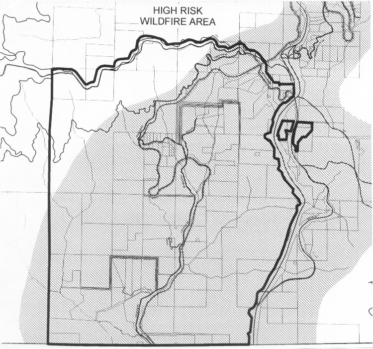
District Map & Geography: High Risk Wildfire Area Map
A larger Version of the High Risk Wildfire Area Map, showing the overlap of the High Risk Wildfire area with the area within the Fire District's boundaries:
Return to Map & Geography Page
Return to CRFD Home Page